
Warnings
The Warnings page displays the latest information in severe weather to ensure your safety from the elements.
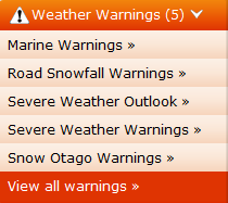
A summary of Weather Warnings is provided in the left hand navigation menu. The number of active national warnings is provided at the top, in the example below there are five. A link to each of the active warnings is provided, along with a link to view all warnings.
The Weather Warnings can be contracted by clicking on the header field, it will then appear as below:
![]()
The View all Warnings summary page appears as below. Active warnings are marked with an exclamation mark, these should match the warnings listed in the left hand navigation. Links are provided to all warnings, even those without any current data.

Weather Warnings:
The left-hand menu lists current warnings.
The main warning page lists the all warning types. If a hazard icon is in place, we have a warning for that type active.
To view an active warning, either navigate to it by clicking on it from the left-hand menu or active warnings, or by clicking on the warning type with the hazard sign.
A warning map is provided to allow users to quickly navigate to any marine warnings in the following regions:
• New Zealand (includes road weather warnings)
• Pacific
• Sub-tropic
• Forties
• Southern Pacific
The following symbols are used on this map to show a warning is in place:
• Gale warning
• Storm warning
• Ice accretion
• Road snowfall warning
Severe Weather Warnings:
MetService will issue these text-based forecasts whenever there is an expectation that any of the following weather conditions will occur within the next 24 hours:
1. Widespread* rainfall greater than 50mm within 6 hours or 100mm within 24 hours;
2. Widespread* snowfall below 1000 metres on the North Island or 500 metres on the South Island with a snow depth of 10cm within 6 hours or 25cm within 24 hours;
3. Widespread* severe gales with a minimum mean speed of 90km/h or frequent gusts exceeding 110km/h
4. *"Widespread" means over an area of 1000 square kilometres or more.
Severe Weather Warnings are classified into one of two categories – Orange Warnings or Red Warnings – depending on the expected severity and impact of the event. The majority of warnings issued will be Orange Warnings, with Red Warnings reserved for only the most extreme weather events.
Severe Weather Watch:
MetService will issue this text-based forecast whenever there is an expectation that conditions may deteriorate to the thresholds specified for the issue of a Severe Weather Warning:
• After the next 24 hours but within 48-72 hours, or
• If there is a high level of uncertainty within the next 24 hours.
Severe Weather Outlook:
Issued daily in the early afternoon and covering the period from midday ‘tomorrow’ through to midday in five days’ time.
These forecasts comprise a mix of text and graphics, where a map of New Zealand shows the boundaries of the forecast.
Severe Thunderstorm Warnings:
MetService classifies a thunderstorm as severe if one or more of the following criteria are met:
• Heavy rain from thunderstorms of 25mm/h or more.
• Large hail of 20mm diameter or more.
• Strong wind gusts from thunderstorms of 110km/h (60 knots) or more.
• Damaging tornadoes with wind speeds more than 116km/h (63 knots) - i.e. Fujita F1 or stronger.
Note: some tornadic systems such as funnel clouds, waterspouts and small land-based tornadoes are possible with thunderstorms that may not be classified as severe.
Severe thunderstorm watches follow the issue criteria for severe weather warnings.
Severe Thunderstorm Watch:
Issue of severe thunderstorm watches follow the criteria for the issue of severe weather watches.
Severe Thunderstorm Outlook:
Issue of severe thunderstorm outlooks follow the criteria for the issue of severe weather outlooks.
Road Snowfall Warnings:
MetService will issue a Road Snowfall Warning for the following locations, whenever there is a likelihood of snow settling on one or more of those roads within the next 24 hours:
• Napier-Taupo Road (SH5),
• Desert Road (SH1),
• Remutaka Hill Road (SH2),
• Lewis Pass (SH7),
• Arthur's Pass (SH73),
• Porters Pass (SH73),
• Haast Pass (SH6),
• Lindis Pass (SH8),
• Crown Range Road, Milford Road (SH94) or
• Dunedin to Waitati Highway (SH1)
Marine Warnings:
Coastal storm warnings:
• Coastal gale warnings
• Auckland VHF for Hauraki Gulf, the area from Bream Head to Cape Colville as well as Manukau Harbour and Waitemata Harbour.
• Ocean Warnings, including large area gale warnings and ice accretion warnings.